


Mapping Out History: From Cave Walls to Google Maps
- Ren Gudino
- May 21, 2025
- 4 min read
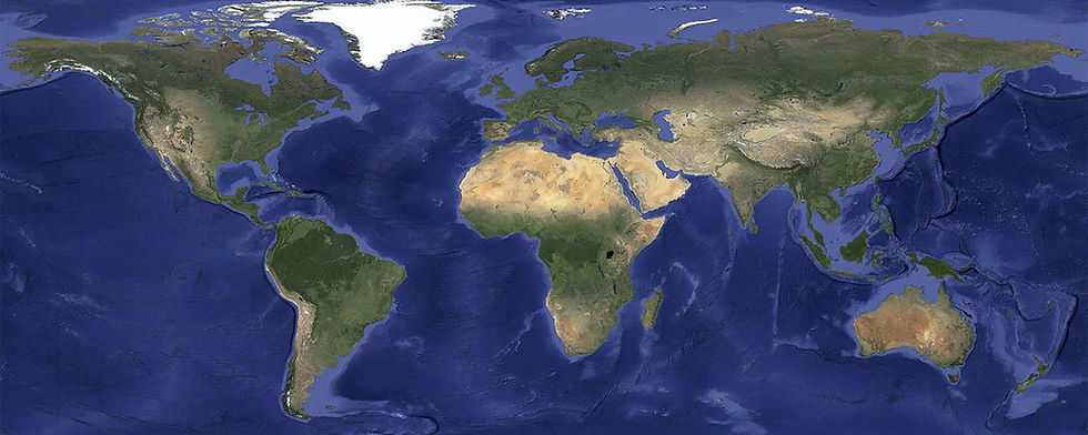
From ancient carvings on stone and bone to our smartphone screens, humans have been captivated by charting their world. For over millennia, maps have evolved, showing a history of commerce, mathematical advancements, and power. What started as artistic representations of nations placing themselves at the center of the universe has gradually become precise scientific programming that revolutionizes navigation, trade, and often, military success. Today, we can pull up detailed maps of anywhere in the world in a split second. Let's explore how maps came to be and how they shaped the way we see our world!

ANCIENT MAPS
Maps have been found as early as 25,000 BC, such as a carved mammoth tusk found near Pavlov in the Czech Republic that showed representations of a mountain, rivers, and valleys. Even earlier, civilizations in Ancient Babylon, Greece, India, China, and Rome created etchings on caves, tusks, and stone in their attempts to map their surroundings. Though these were very rough and hardly helped as far as indicating exact distances, Ancient Babylon did utilize one of the earliest forms of surveying techniques. The map, dated between the 25th and 24th centuries BC, uses varying lines to indicate hills, rivers, and cities, and is even marked to show directions. The first world map has been credited to Anaximander of Miletus, who drew the world as a pillar. Though this map did not survive, Hekataeus of Miletus produced a map that he claimed was the improved version, with the Earth drawn as a disk in the middle of an ocean, putting Greece in the center.

From this description of ancient maps, accuracy was clearly not as much of a priority as having a representation of the world with one's own country at the center. Even centuries later, Rome depicted a detailed map of their empire on a scroll that was nearly a foot tall but dozens of feet wide — an impossible representation that was created simply to show the expanse of their domain. For accuracy, we have to credit Ptolemy.
THE FIRST ADVANCEMENT
In the 2nd century AD, astronomer and astrologer Claudius Ptolemy gathered detailed documents describing town locations reported by travelers. He established the system of longitude and latitude lines, mapping 10,000 places across Britain, Europe, Asia, and North Africa. Like other Greeks and Romans, he understood that the Earth was round and developed a method to "flatten" the globe into a two-dimensional image—effectively inventing geography. After the fall of the Roman Empire, his groundbreaking map vanished for a thousand years.

COMMERCE & THE NEW WORLD
Once the Renaissance dawned, from the 14th to the 17th century, ships were crossing oceans for trade and kings were building empires. Ptolemy's work was rediscovered and, thanks to the invention of the compass, maps could now be made from port to port, helping guide sailors and leading to brand new maps based on his calculations from a thousand years prior. However, two significant errors in Ptolemy's work emerged: he had calculated the world to be 30% smaller than its actual size, and he had used Arabian miles instead of the longer Italian miles. This is why Columbus assumed he'd have a short sail to Asia and ended up in America. This also led to the presence of the New World on maps — or rather, the coasts and major rivers.
THE POWER OF MAPS
The next biggest map innovation was the Mercator Projection in 1569, when Gerardus Mercator widened the landmasses and oceans farther north and south — which was helpful for sea voyagers but unfortunately distorted a number of countries. However, the advantages outweighed the disadvantages, since seafarers could map more accurate routes to pursue trade, bringing commerce to their homelands. Though ancient maps might have been artistic representations of power, these accurate maps gave nations real power through enhanced trade, military advantage, and safer sea voyages

In the late 19th century, advancements in mathematics and measurements led to the next surge in mapmaking improvements. The Cassini family crossed France to calculate the dimensions of the country — with this information, they were able to use triangulation, which used trigonometry to take a few measurements and map out large areas. This advancement, along with binoculars that allowed the viewer to measure miles at a glance, led to our first accurate maps.
The discovery of the Doppler Effect and radio technology built upon these advancements, creating maps that proved crucial to military success in World War II. Winston Churchill is even famously remembered as having a dedicated "map room," where maps covered the walls, giving him a clear way to visualize how to protect Britain's coast. Military defenses were boosted with such excellent navigational technology, particularly the Navy's missile submarines. The technology spread all over the world, with nations facing a new challenge: protecting their systems from hacking and tampering—a problem that persists today. (More about how GPS changed the world can be found here.)
HOW GPS AFFECTS US
While early maps were artistic symbols of power that gradually evolved into tools that could create real power, modern-day GPS causes controversy. A 2008 study in Japan showed that people who used GPS to get through a city had a weaker memory of the terrain compared to people who utilized a paper map. A 2008 study at Cornell showed that people who used GPS paid less attention to their surroundings. These studies argue that our modern-day GPS usage is decreasing our ability to note our surroundings.
However, David Rumsey (who created Stanford's self-named map collection) disagrees. He contends that GPS and online mapping are exposing us to maps way more often than ever before. This is true: How many times have you ordered food, looked up the nearest place to get your car fixed, or the number for your doctor and been shown an accompanying map? We might feel like we need GPS to reach our destination, but there's a possibility that these map images have actually been integrated into our internal navigation, giving us a better sense of where things are because of it.
Whether we're losing our ability to make mental maps or developing a stronger sense of where things are, one thing is true: what started out as a way to toot one's horn has turned into an incredibly valuable system, giving nations military advantages, generating wealth by way of commerce, and sometimes resulting in the discovery of new lands. Whether you're sticking to your paper atlas or using your smartphone's GPS to cross the country, remember that Interstate Signways marked the way!


Comments